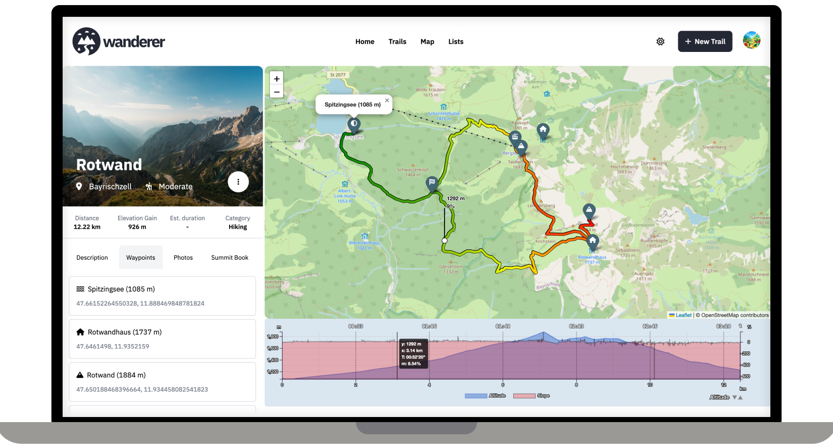
Strava has continued to enshittify the app to the point that I'm getting ads after every activity. Anyway, I decided to delete it after yesterday's run and will keep an eye on this project. Thanks!
post
I LOVE THIS.
Self hosted, GOOD LOOKING (rarity in FOSS), nice to use and privacy-aiding.
Thank you so much!
This is an excellent use case for a self hosted service, since location data is frequently used for nefarious purposes.
The screenshot looks awesome! I'm currently on vacation and will definitely try it out.
Welcome to Lemmy! I recently posted about Wanderer also in another self-hosting community: https://slrpnk.net/post/7887187
As someone interested in self-hosting this, I have two questions:
How far is it suitable for say a local hiking association or a small municipal government to use this as a public trail database to promote regional eco-tourism efforts? Where I live the local government has something like that, but it is badly maintained. For that to work it would need to have the ability to easily find trails on an overview map and to allow posting notices about trail closures etc. (ideally even crowd sourced?) Maybe also some way to mark trails as official, if they are designated and sign-posted.
Unrelated: have you thought about allowing the live-tracking via apps like Phonetrack or OSMand? I think that would make it both more convenient for uploading tracks (at least where there is sufficient cell-coverage) and might add an interesting social aspect to it if you can share your live-location with other users.
P.S.: Would be great if you could add it to https://translate.codeberg.org/ for adding additional languages easily.
Thanks for promoting wanderer! Finding trails on the map should be no problem, you can currently mark trails as public so that not logged-in users can see the trail. I have thought of steering wanderer towards a more socially interactive platform. I think a good first step would be to allow comments and implement a rating system.
Thanks for the crowdsourced translation website. I was looking for something like this. I will set it up and add it to the contributing section of the documentation.
Would be nice with activity pub support for sharing planned and recorded trails. Cone to think of it. Does it make that distinction? Planned vs recorded? How about a planning, route finding mode?
Kudos to your project so far!
I'm not sure if I understand your question correctly. Do you mean creating a trail from scratch on the map without recording it before? That is indeed on my roadmap.
That and sharing it with other users through the ActivityPub protocol (what Lemmy uses)
I see. I'm unfamiliar with the protocol, but sharing trails is definitely on the roadmap. So I will look into it!
Wanted to ask this. Is it difficult to implement activity pub? That would be awesome. It looks beautiful
I think you might misunderstand what wanderer does. It is not a maps service like Open Street Maps. It's simply a database in which you can store your GPS tracks. So the workflow would look like this: you are in the woods and record your track (e.g. with osmand) -> you store your track in GPX format -> you upload your track (and any additional info like a description or photos) to wanderer -> before your next adventure you check wanderer to decide what you want to do
Logging trips offline requires background location services. This does not work for a simple website. You would need to program an app for that. While this is a plan somewhere down the line, it's still far away. So currently I would recommend relying on an external app to log your trip and import afterwards.
To plan, organize or review routes.
This seems more like Garmin Basecamp, it's not supposed to be used on the routes themselves I'm guessing.
Soooo cool! If it could get from gpx the dates when activities where made, autoimport multiple gpx files, bug fixing, tableview (small overview from all activities) it will be my Strava killer..
Great work! Thx
How do I change port to something else? 3000 is already used by Gitea :)
With docker you can simply change the port mapping in the compose file
This is very nice :) I was working on a proof of concept similar to this to have a quick search functionality for FrankenJura (german hiking database) but it was lost in a drawer due to lack of time 😁 Great work and thanks for sharing it :)
Happy to help. If you can get a dump of the database it should be quite easy to import it into wanderer via the API 👍
Any chance to pack it into a single container instead of three? Would make it easier to work with unraid.
Database is rarely, if ever bundled into the app container, unless it's SQLite.
What's the scope of this, just a route catalogue or will it sort of become a hiking tracker as well?
wanderer currently parses distance, elevation gain, duration and speed. Parsing heart rate would be an easy addition, though.
Nice ! You made me think of spinning up a little server. It's been a while since I've dabbled in managing a server and not aure I have the time for that. But you made the chances if me going for it much higher.
Would a raspberry pi 4 be enough for running it ?
Love it.
I've been willing to learn more about programming with location/map data so definitely checking this out.
Are you looking for contributions or help on anything? I think I might at least look at providing a Dutch translation for the front-end if you're accepting PRs.
These may be answered elsewhere, but like some other interested people in this post, I fully intend on trying to load a copy of this when I get home from vacation.
What methods/devices do you use to upload/sync the data? Other than a regular smart phone, were you able to use other GPS enabled devices like garmin or apple smart watches?
And system requirements?
top 50 comments