1


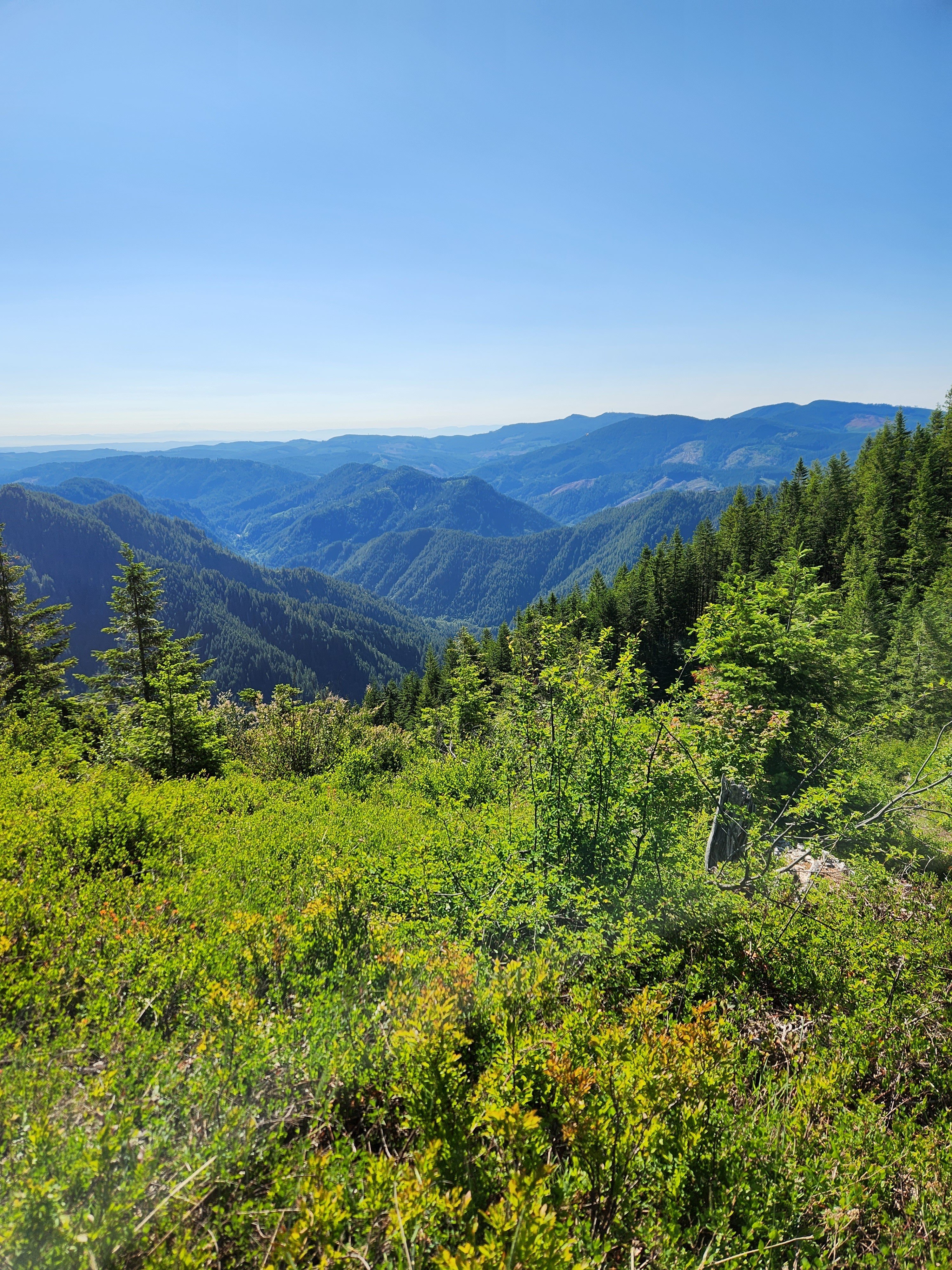
Conditions were occasionally sandy, and I had shoes with netting on top for breathability.

They're wool. I held them over the fire every night, just close enough to get them hot enough to kill bacteria. But you can't replace soap and water.

How do through hikers do it?!

2


I'm trying to find information on this. So far their website has no useful information besides sanitizing with a bleach water mixture.

Several reddit threads have people arguing everything from buying a new one every year, to storing it dirty and never having a problem, to completely drying it out.

I currently use a life straw bottle, I drink out of it while hiking, and just turn it over and squeeze the bottle into some larger bottles to use for cooking and stuff. It's not ideal and I'm looking to change it up. Currently I store my life straw bottle in between trips by following their instructions, sanitize with bleach water, rinse, then fill with salt water mixture to prevent growth and keep it wet. Drying the filter ruins its ability to get wet again, and therefore it doesn't filter well.

What I'd like to do is store the Sawyer squeeze the same way, sanitize, rinse, store in salt water, maybe in a mason jar? But would that damage it? Does drying it ruin it too? Some people complained it's hard to actually get it dry.

How in the world is it that there is nothing in the manual or the FAQs about storage?

3


I forgot my wind shield, so it took way longer and way more fuel than necessary. But we got there in the end. It was just a day hike, after all.

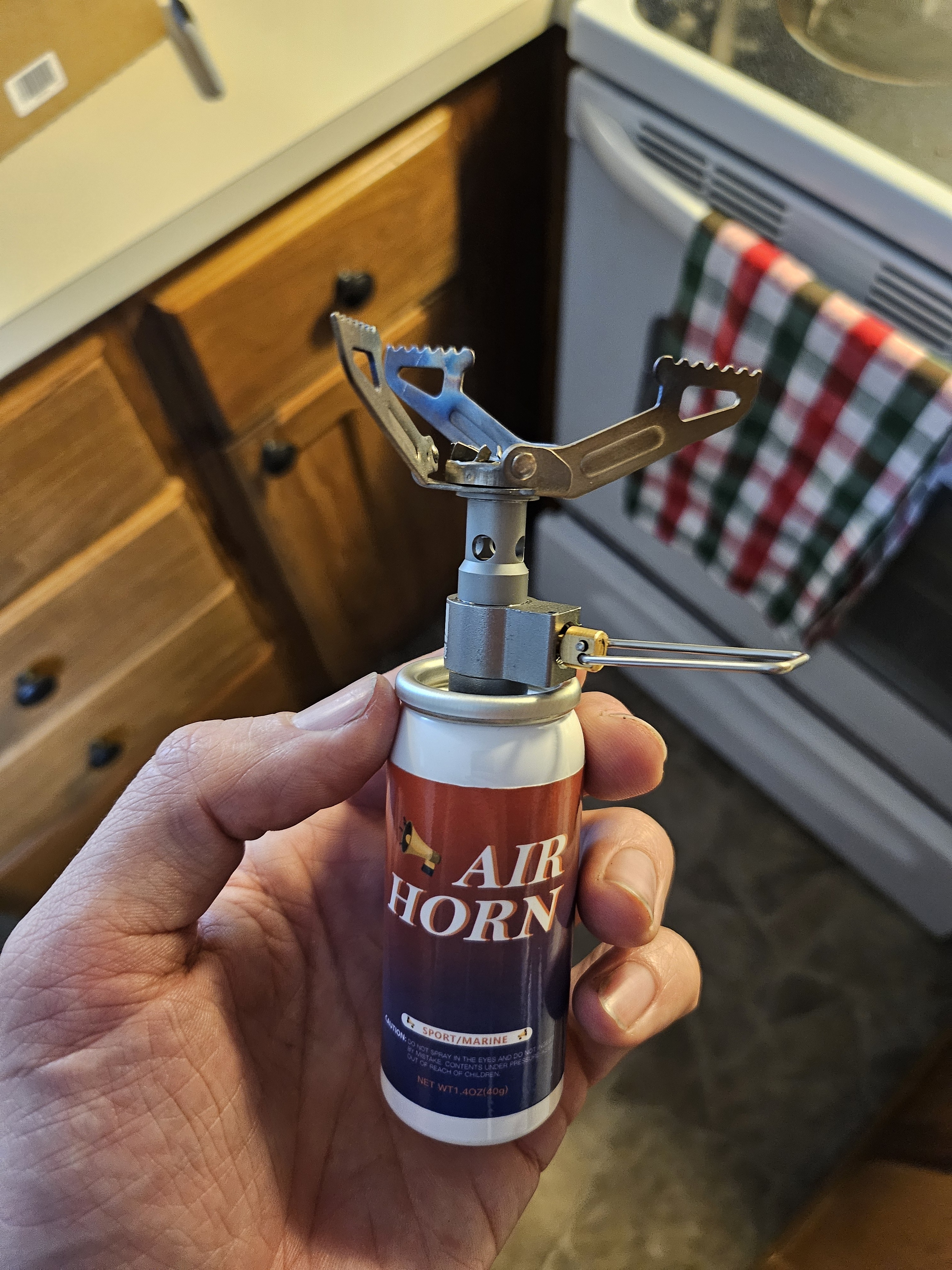
For those curious, this is a "cat can" stove, or "super cat". I can't speak to its effectiveness, as I used it wrong. But a lot of people really like it. And it weighs basically nothing!

Edit: formatting

4


I am looking for a light trekking tent and currently I am considering the Hubba Hubba and the Dagger. Does anyone have experience with one (or both) and can share some longterm findings?

Edit: Or other recommendations!

5
 
 
6


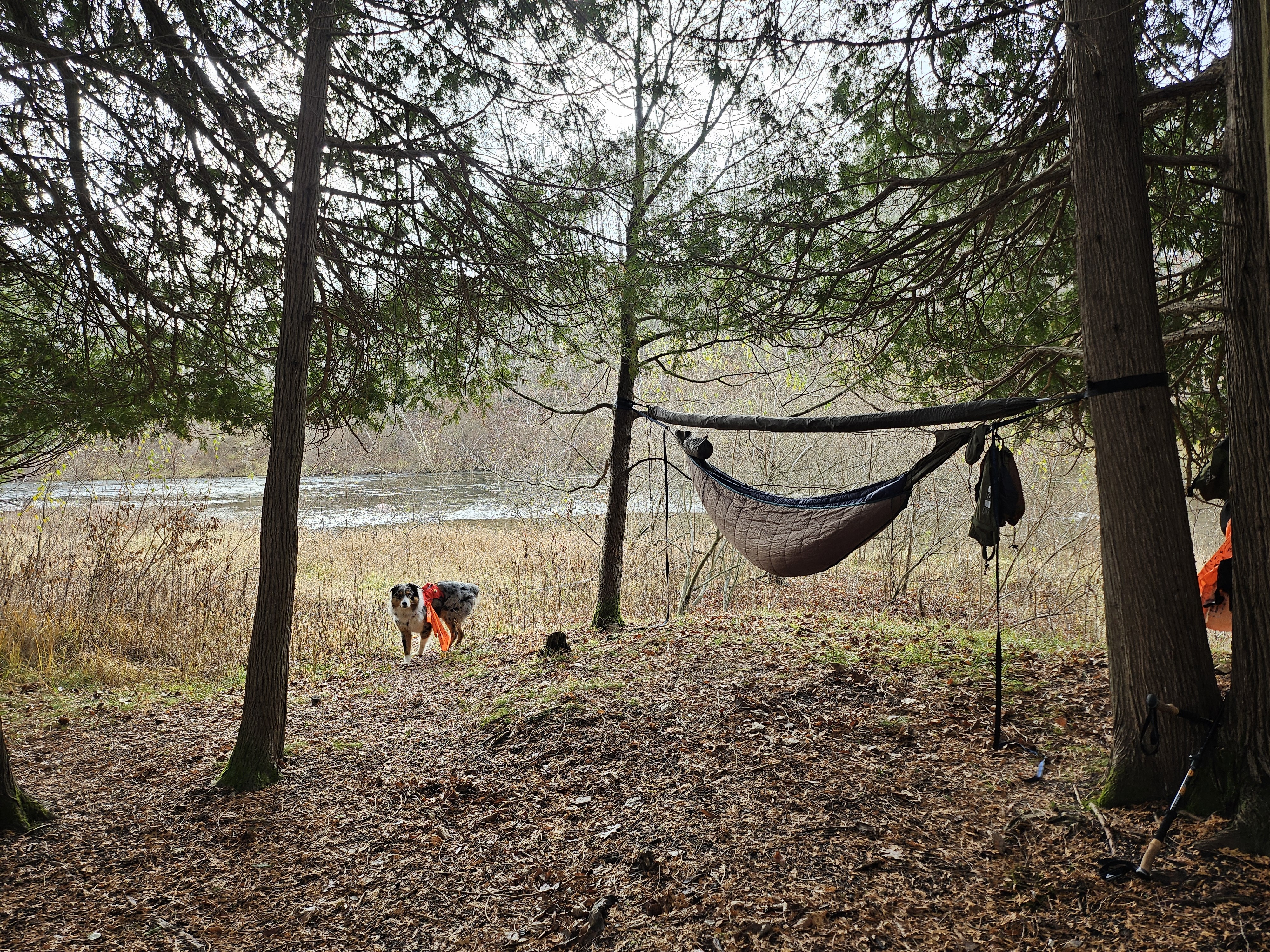
It was supposed to rain, but we pressed on, and it ended up being beautiful. Chilly but pleasant. Just cold enough to make you appreciate the warm fire. Plus the sound of the river to lull you to sleep.

Hard to beat!

I usually go with dehydrated meals, but packed heavy on real food this time, for science. I got myself a small lightweight nonstick pan, and fried up a whole steak for dinner, bacon and eggs for first breakfast, and pancakes and eggs for the second breakfast. I only had one dehydrated meal this trip. I learned a lot!

7


While it is true that the Appalachian Trail Conservancy, the nonprofit that helps manage the path and the lands surrounding it, has advised hikers to stay off the southernmost 865 miles, or its lower third, it is not true that those miles are destroyed. Sources I spoke to talked of toppled trees, down branches, and flooding.

8


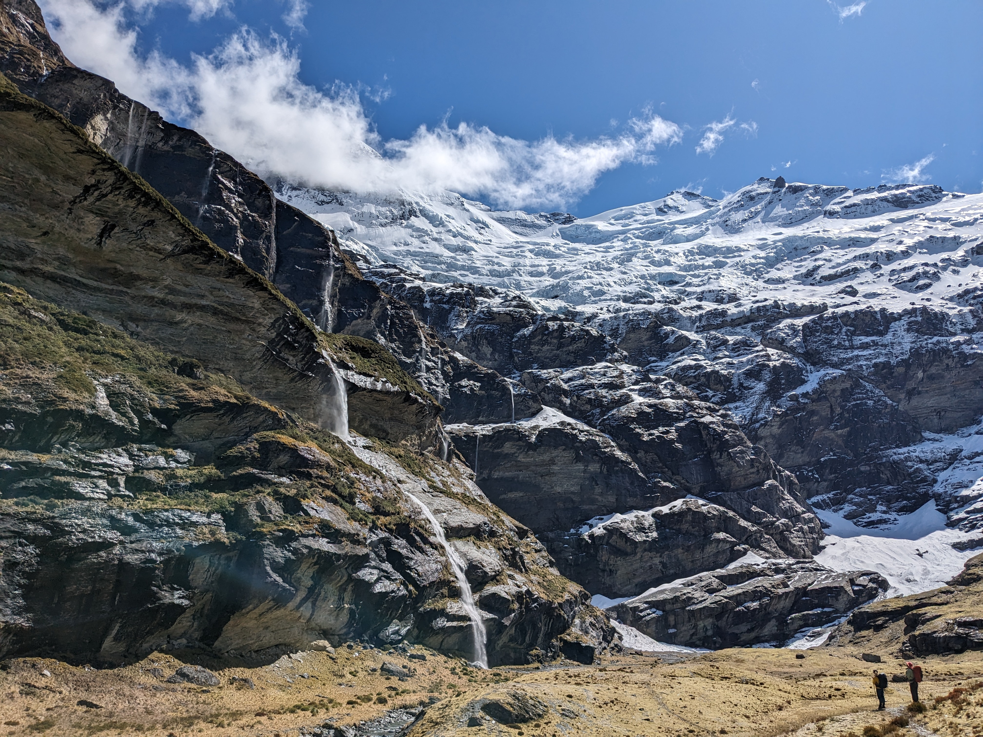
Earnslaw Burn, under Mt Earnslaw (Glenorchy, New Zealand)

9
 
 
10


A trio of Alabama and federal agencies are joining forces to oversee upgrades of the Pinhoti Trail, a major resource in the state for hikers, backpackers and other outdoor enthusiasts.

The Pinhoti National Recreation Trail covers more than 330 miles in the southern reaches of the Appalachians in Alabama and Georgia. Its 170 miles in Alabama start at a southern trailhead at Flagg Mountain southeast of Birmingham in Coosa County; from there it works northeastward, passing through Cheaha State Park and crossing into Georgia in Cherokee County, northeast of Piedmont, Ala. Since 2006, it has provided a connection to the Appalachian Trail.

According to information released on Tuesday, the Alabama Forestry Commission, the Alabama Department of Conservation and Natural Resources and the USDA Forest Service have agreed to form a governance board. The board will “provide collaborative leadership in developing, restoring, and maintaining the Alabama section of the Pinhoti National Recreation Trail [as] a sustainable outdoor recreation resource.”

Alabama Gov. Kay Ivey, Alabama State Forester Rick Oates, ADCNR Commissioner Chris Blankenship and Alabama’s USDA Forest Service Supervisor, Cherie Hamilton, signed a Memorandum of Understanding for Shared Stewardship.

“In Alabama, we recognize the vital importance of protecting our state’s natural beauty and maximizing opportunities for residents and visitors alike to get outdoors and experience it for themselves,” said Ivey. “The Pinhoti Trail is a major asset to outdoor recreation-based tourism in Alabama, and restoration and maintenance of this trail is a team effort.”

“The Pinhoti is so important to Alabama, especially for the hiking community,” said Blankenship. “And there’s been a lot of different groups that are involved on the Pinhoti, with maintenance or upkeep on different sections. But there has never really been a group from state government that kind of spearheaded any of the coordination to make improvements.”

Blankenship said there’s already a comprehensive study laying out priorities for what the Pinhoti needs. In 2019, the Alabama Trails Foundation published “The Alabama Pinhoti Trail Built Environment Master Plan.” The 133-page document can be downloaded from alabamatrailsfoundation.org.

The master plan describes Alabama’s Pinhoti as “a regional treasure that is the result of years of volunteer and government collaboration” that “provides hikers with the opportunity to immerse themselves in the wilderness, as well as experience multiple natural, scenic, cultural and historic opportunities along the trail. Due to the increasing popularity of the trail as a hiking destination for distance or day hikers, the demands on preserving and maintaining the trail have increased. With limited maintenance and funding, it is vital that all resources are allocated to ensure the long-term sustainability of the trail.”

The authors also say that the trail “is supported by passionate volunteers. There are individuals donating over 1,000 hours of volunteer time each year, and these are working hours of hard physical labor in all types of terrain and weather. However, with few exceptions there is little in the way of support from local communities or businesses. When objectively evaluated against the rigor of current definitions of sustainability, the Pinhoti is a threatened resource.” They see signs of hope in “a new engagement by Alabama citizens” organizing for various reasons to support the trail’s potential for economic, social and environmental impact.

The new agreement “really brings together the three largest landowners on the Pinhoti, which is the Forestry Commission, the U.S. Forest Service and the Department of Conservation, both through the Forever Wild program and through Alabama State Parks,” said Blankenship. “We all hope to work together to implement improvements on the Pinhoti and bring it up to the National Recreation Trail designation, to get that designation.” The new governance board wants to work with volunteer organizations supporting the trail, Blankenship said.

Blankenship said the master plan “has a good roadmap of the things that need to be done in the Pinhoti.” He said that includes “More shelters, better signage, getting some of the roadwalk out of the Pinhoti, get it off the road and into the woods in a couple of places where it’s on the road.”

It’s too early to tell how soon trail users will see improvements steered by the new board, but Blankenship said he hopes it won’t be long.

“We’re at the beginning but we’re working on some funding opportunities to be able to do some of the work on the trail,” he said. “We hope to have more information about that in the next couple of months.”

11


As America has transformed, so too has its celebrated footpath. Less than half the A.T. remains where it was originally laid.

12


cross-posted from: https://iusearchlinux.fyi/post/417724

I day-hiked in to the Bighorn Crags area a couple of weeks ago. The Bighorn Crags are named for their bighorn sheep and really cool craggy granite mountains. They are quite old and eroded, with lots of cirques, crags, and towers. I would recommend getting to the trailhead and camping, then backpacking in for a few days.

Getting to the trailhead is a 2.5 hour drive from Salmon, Idaho through forest service roads. The first 1.5 hours are fine - well maintained dirt roads with easy grades. The last 18 miles takes an hour on a really crappy road deep into the mountains. Tire popper rocks abound, so be careful and be prepared! There is a campground at the trailhead.

The trail system is such that you hike along a ridge line for about six miles until you reach the major crags.

From the trailhead you almost immediately hit the Frank Church Wilderness boundary. You will pass some trails to go to a couple of lakes but they are some distance away and a hike down from the ridge line. The ridge line is dry, so bring water.

The first lakes you reach in the crags are Wilson Lake and Harbor Lake at about mile 7.1.

The trail bounces around between about 8500' and 9200' elevation. However, one way is about 1700' of ascent, meaning we had 3400' ascent and 3400' descent in 14 miles round trip.

13


cross-posted from: https://iusearchlinux.fyi/post/277201

I took this out-and-back hike in August 2022. It was a 9.3 mile hike one way. You start in relatively populated national forest land and then as you rise through the mountains, reach the Wilderness area. The trail climbs through Bear Basin, switch backing up the bowl of the basin to the first pass, which is stunning. The descent down the pass is rough with lots of steep gravel. The trail splits and you take the high trail to the east, over the next pass to Summit Lake, which is nestled between two mountains, then over the lass tiny pass and down into the last, big basin. Hike along the meadow until you reach Thompson Lake at the foot of Gallatin peak. You can summit the peak, but I didn't. I surely didn't see a reasonable trail up it!

Elevation

Trail on quad chart

Looking into Bear Basin Looking into Bear Basin

Wildflowers Wildflowers

Looking down into Bear Basin from the pass Looking down into Bear Basin from the pass

Summit Lake Summit Lake

Towards Thompson Lake Towards Thompson Lake

Thompson Lake Thompson Lake

Sunrise at Thompson Lake Sunrise at Thompson Lake

14
Gregory Rhune 22 Review (www.gregorypacks.com)
submitted 3 years ago by to c/backpacking@lemmy.ml


Hello! I have bought a Gregory Rhune 22 backpack a few weeks ago and I want to make a review to contribute to the community!

So, first off: this is some of the most thoughtful organization I have seen in a backpack. You can tell that this bag was made by people who would want to use it. It has everything you need for day-to-day organization, even down to a dedicated AirPods/earbuds pocket right on your left strap that I use every single day (so so convenient).

So pros:

  • it is a Gregory pack, so it comes with the Gregory quality and warranty support you would expect from them.

  • Made with lightweight recycled rip-stop polyester (in some places, too much so)

  • Organization is abundant. You will not run out of places to put things in this bag, and I have lost my habit of letting things fall to the bottom of the bag immediately after getting this due to its thoughtful organization.

  • Almost clamshell main compartment is great for travel, and the fact that it opens right up with no lip on top of the (wonderfully false-bottomed) laptop pocket means you will not miss a dedicated laptop compartment at all. Even if it is fully packed, you will have no troubles just getting your laptop out of the bag in a single zip.

Cons:

  • the lightweight, thin rip-stop is great for hiking bags and bags of that sort, but I feel like Gregory definitely should have added some more durable fabric or at least a protective PVC or TPU coating to the bottom of the pack, similar to how The North Face does things on their commuter bags. The single thin sheet of fabric on the bottom of the bag has no padding at all, leading to sagging if you put something even slightly heavy in the main compartment, and offers no drop protection for anything in the main compartment. Though, this can be easily fixed with just a piece of cardboard cut and put into the bottom, but that’s an extra hassle that should have been fixed in the beginning imo.

  • the entire bag is made from the same recycled plastic material, which is great for the environment, but that plastic is rough, especially on the straps and back of the pack. It sorta scratches you every time you put the pack on. This is a non-issue once you get used to it, but if you are expecting some soft material, this is not it. I also wonder how the rough material rubbing on your back all day would affect shirts with graphic designs on the back.

  • lack of a bungee system kinda sucks, as I wish I could just throw a wet jacket outside of the pack itself, but it’s not like you expected it to come with one if you looked at the listing.

  • the water bottle holder is verrrry loose for bottles less than 30oz or less than 3” in diameter. My 24oz hydroflask has slipped out multiple times while putting it down. I wish it had some securing straps over the holder like TNF borealis or recon does.

Overall, this is a great pack, but misses the mark on a few things that you would not think of when you use it, but seem like a bit of an oversight when you use it regularly and notice those things. For the price I would expect just a bit more durability on the bottom of the pack especially, but if I’m honest, I believe this will be a non-issue unless if you are very rough with your pack. Rip stop is a great material, but if there is only a single thin 300d layer, things can happen. Regardless, I love this pack, as I would not find such thoughtful organization and zipper placement in any other pack I have researched. Just a few improvements would make this the perfect go-to commuter backpack.

Hope this was insightful to anyone looking for a new bag!

15
submitted 3 years ago* (last edited 3 years ago) by to c/backpacking@lemmy.ml
 
 
16


A 71-year-old Los Angeles man died in California’s Death Valley National Park on Tuesday, likely due to heat, as the afternoon high recorded in the park was 121 degrees, officials said. The Inyo County Coroner identified the deceased as Steven Curry.

Curry fell to the ground outside the restroom at the Golden Canyon trailhead, the Inyo County Sheriff’s Office and the national park wrote in a news release.

Before collapsing, Curry had been interviewed in the early morning by a Los Angeles Times reporter at Zabriskie Point; he had hiked about 2 miles from Golden Canyon to the point.

17


cross-posted from: https://iusearchlinux.fyi/post/66105

As promised, here is a trip report!

Trailhead: Palisades campground Path: hike past Lower Palisades lake (4 mi), Upper Palisades lake (7 mi) and into Waterfall Canyon (end at 11 miles).

The snow has melted and the Palisades are in full growth mode! Tons of flowers are blooming or preparing to bloom in the next couple of weeks. Patches of snow still exist in Waterfall Canyon starting at about 7400 ft elevation. There were two waterfalls flowing at the end of the canyon. We camped in some nice established campsites to the west of the trail by one of the lakes at the end of the canyon. It was a quiet day with no other people out past Upper Lake.

(Palisades creek is super fast this year!)

(Upper Palisades Lake is beautiful)

(The main waterfall)

(The other waterfall)

(Lake we camped by)

18


cross-posted from: https://iusearchlinux.fyi/post/354323

Did a quick day hike last weekend to Goldbug Hot Springs in Elk Bend, ID. It's a little under 2 miles one way, and about 900' elevation gain - half of it in the last quarter-mile. You start at a trailhead next to private land and hike about a quarter-mile through private land (it's allowed but stay on trail, dogs on leash and keep your noise level down).

It was very hot in the afternoon and there is little cover, it improves as you approach the hot springs. The springs actually spring cold water and hot water, and some pools are hotter than others, so explore!

The map The map

The approach - the springs are up in the mountains

The vew from the springs back down

The hot springs

19


I went here with my 6 year old daughter and my parents this past weekend. I grew up coming here with my dad and it feels really special to share it with my daughter. I can't wait to go back.

20


Looking for a new backpack. I don't like having 40 pockets to stash stuff in. I would prefer a frame but not having one isn't a deal breaker. Have lower back issues so it needs to sit appropriately.

MOLLE, ALICE, ILBE, or FILBE? Something else?

21


One of my favorite campsites. I did the North Lake to South Lake loop (about about fifty miles) back in 2020.

Sadly, most thru-hikers on the Pacific Crest Trail or the John Muir Trail will hustle past here, as they’re always trying to get from Muir Pass to Muir Trail Ranch (or vice versa, if they’re southbound) in a day. But, it’s a beautiful place, worth stopping to see at different times of day.

Deer grazed in the meadow, as well as in my campsite as I made my morning coffee. If you’re an angler, Evolution Creek is full of golden trout, and make for a fantastic diet addition along the trail.

It is one of the most peaceful places in the Sierra Nevada, if you visit at the right time of year. This was back in late 2020, and I was able to be all alone here, due to the pandemic keeping the backpackers’ numbers down.

22
submitted 3 years ago* (last edited 3 years ago) by to c/backpacking@lemmy.ml


A link to a website if you want to buy good quality hiking items on aliexpress.

The ratio price/weigth is usually good, not ultralight, but correct

23


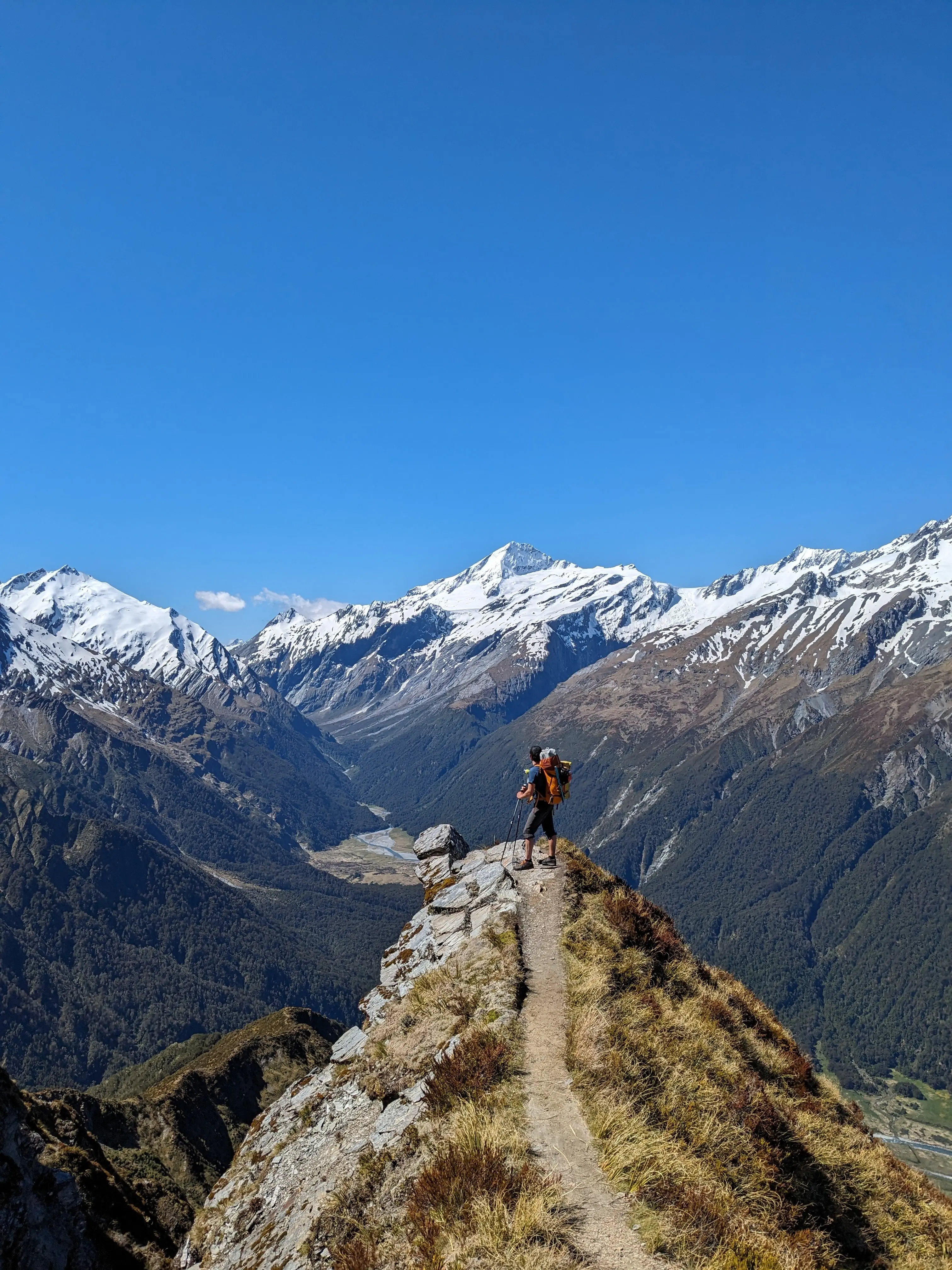
This was taken last January during my wife and I's thru hike of Te Araroa. Photo credit~ my wife.

24
submitted 3 years ago* (last edited 3 years ago) by to c/backpacking@lemmy.ml


Recently did a 2 day trip that looped up to this summit. There were some intense inclines and a few scrambles, but the views were incredible.

25
Not ultralight gear list (lighterpack.com)
submitted 3 years ago* by to c/backpacking@lemmy.ml


I'm new to the community and thought a little activity on the community couldn't hurt!

I am a pretty large guy (6'2", 240lbs) who's also pushing 50. As much as I'd like to do ultralight, I struggle to keep my base weight around 20lbs because I need large gear and sleeping on the ground is not that sexy for me. Plus... I have a chair because sitting on the ground is about as unsexy as sleeping on the ground is. I started off with a 50+lb pack and have gotten better gear as I've gotten more into backpacking.

I've done the CA section of PCT and now I do section hikes on the AT as I live on the east coast now. My trail name is JoePaca, and if you've seen me at a camp, I'm pretty easy to remember.

I'm happy to give honest opinions on any of the gear in my list, but I'm pretty happy with all of it.

view more: next ›